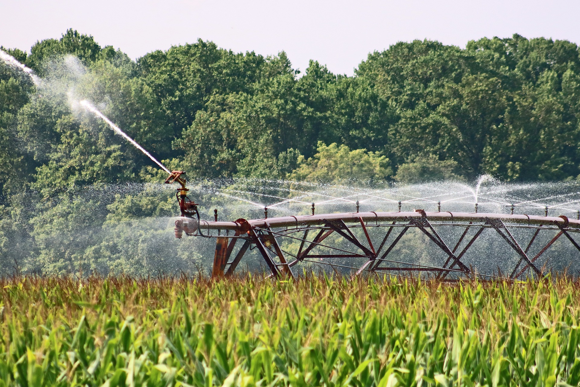
 Irrigation in a maize crop field. IMAGE: Pixabay
Read the news published on ESA Earth Online
A new study by isardSAT and IRTA provides for the first time a method to classify irrigation systems (flood, sprinkler, drip) and not irrigated fields using remote sensing. This methodology, replicable to several agricultural areas, has mapped in Lleida (Spain) the ongoing modernization of the irrigation systems, which remained unseen within the available databases.
The study Classification of Different Irrigation Systems at Field Scale Using Time-Series of Remote Sensing Data offers a new approach that employs machine learning models (ML) that use time-series of remote sensing data in the Catalan region of Lleida (Spain). This methodology is replicable to other agricultural areas, and provides relevant information that can improve irrigation water management in the analysed sector. Such models have been able to distinguish different irrigation systems regardless of the crop types present in each field.
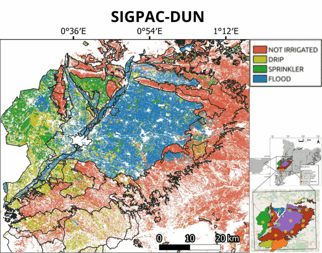 Map comparation of the irrigation systems declared by SIGPAC-DUN and isardSAT’s ResNet prediction. The ResNet results, in comparison to the SIGPAC-DUN data, show the current modernisation of the irrigation system (from flood irrigation to sprinkler) and the expansion of the drip irrigation in areas that were not irrigated before.
IMAGE: isardSAT.
Map comparation of the irrigation systems declared by SIGPAC-DUN and isardSAT’s ResNet prediction. The ResNet results, in comparison to the SIGPAC-DUN data, show the current modernisation of the irrigation system (from flood irrigation to sprinkler) and the expansion of the drip irrigation in areas that were not irrigated before.
IMAGE: isardSAT.
Different machine-learning algorithm models have been used for the study, along with remote sensing products from SMOS/SMAP, Sentinel-2 and Sentinel-3 satellites concerning evapotranspiration and soil mosture data. From the results obtained, maps of irrigation systems were created, delivering detailed information on the status and evolution of irrigation practices in an intensively cultivated region in Catalunya, Spain.
This machine-learning models have been trained with ground truth data from more than 300 fields across the area, collected during a field campaign in 2020. When compared to the field data, results from the ResNet model used show a high precision, and reveal some changes that were not registered in the official databases.
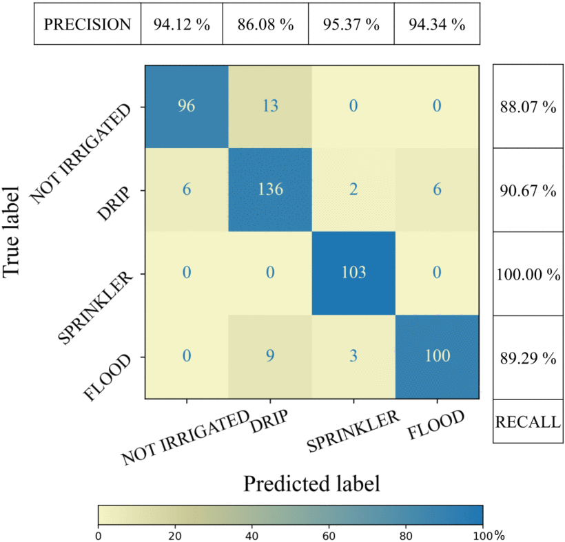 Results from the ResNet processing show a great precision compared to the field data.
IMAGE: ResNet results (isardSAT).
Results from the ResNet processing show a great precision compared to the field data.
IMAGE: ResNet results (isardSAT).
Information about irrigation systems in use is difficult to gather, and it appears frequently outdated in the databases – when available. However, it is essential for irrigation districts in order to manage its water resources. Especially in the Mediterranean area, where climate change has extended and worsened drought periods.
Article citation:
G. Paolini, M. J. Escorihuela, O. Merlin, M. P. Sans and J. Bellvert, “Classification of Different Irrigation Systems at Field Scale Using Time-Series of Remote Sensing Data,” in IEEE Journal of Selected Topics in Applied Earth Observations and Remote Sensing, vol. 15, pp. 10055-10072, 2022, doi: 10.1109/JSTARS.2022.3222884.
