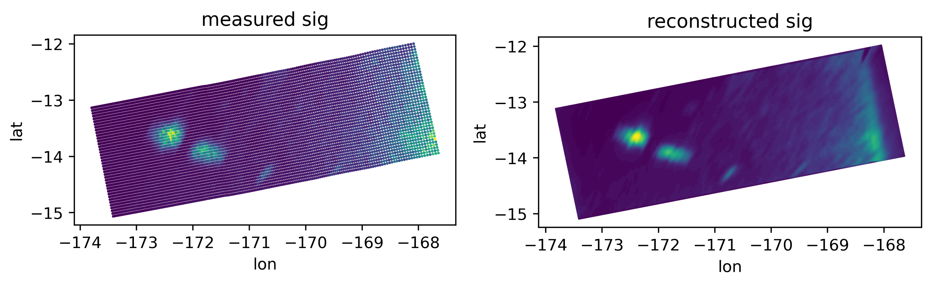
Measured backscatter over the Samoan islands with ASCAT (left); reconstructed image using the SIR algorithm (right).
Spaceborne scatterometers are microwave radars capable of determining the scattering properties of the Earth surface by providing measurements of the normalized radar cross section. These measurements are key in climate studies, weather forecasting and storm monitoring. Scatterometers provide two-dimensional images with spatial resolutions of the order of 15 to 50 km, that due to the radar processing characteristics give the effect of blurring targets.
The goal of the project is to define and implement different algorithms to deblur ASCAT and SCA image data.
isardSAT is responsible for the review, selection, and development of the different deblurring methods, and support to the implementation, performance assessment and validation activities.