 UAWOS combines satellite EO data with UAS hydrometry datasets
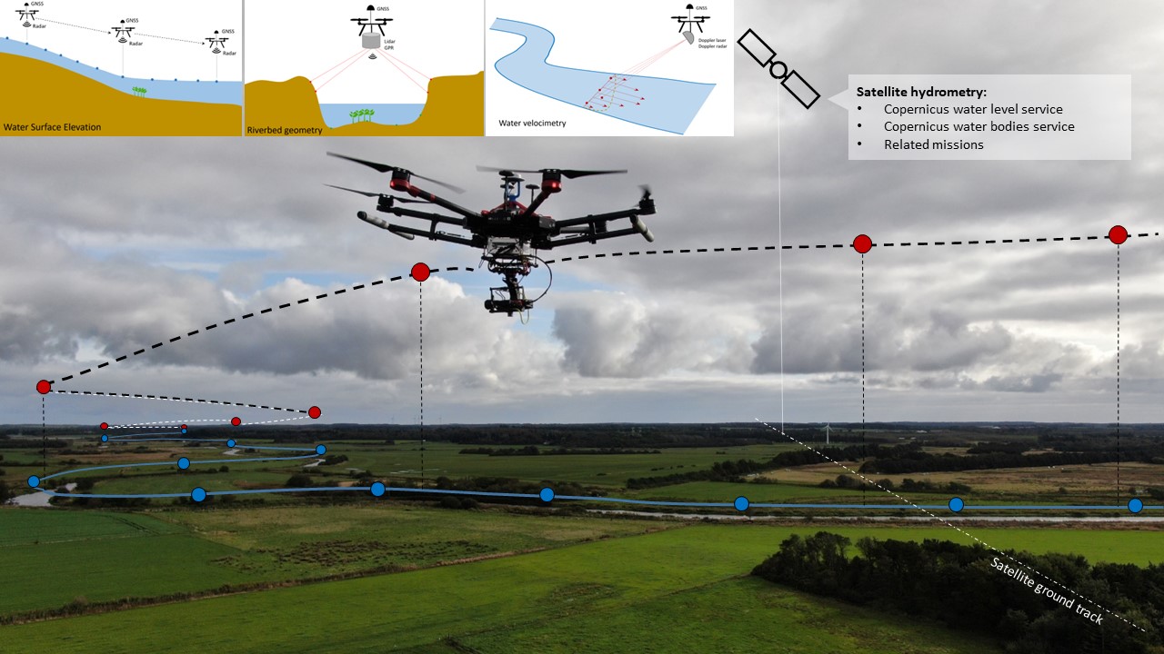
The UAWOS project develops airborne and contactless hydrometric sensing technology to inform climate change adaptation, assess flood risk and manage extreme hydrologic events in poorly monitored rivers. The project aims at bringing sensing technology and surveying workflows to the market and demonstrate data value in a range of use cases in alpine, Arctic and tropical regions.
UAWOS combines satellite EO data with UAS hydrometry datasets to enhance the value of its data and develop new data products from satellite EO datasets. Such products will enable the validation of inland water level services based on Copernicus and other satellite altimetry missions; and the conversion of water surface elevation time series at virtual station into river discharge estimates.
isardSAT contributes with innovative satellite altimetry processing such as FFSAR to enable an unprecedent spatial resolution down to the meter scale.
Go to project site